


Watertown Precinct 1, Middlesex County, Massachusetts
About
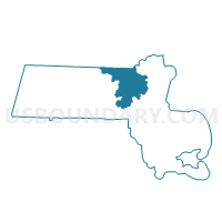
Outline

Summary
| Unique Area Identifier | 594842 |
| Name | Watertown Precinct 1 |
| County | Middlesex County |
| State | Massachusetts |
| Area (square miles) | 0.91 |
| Land Area (square miles) | 0.86 |
| Water Area (square miles) | 0.05 |
| % of Land Area | 94.48 |
| % of Water Area | 5.52 |
| Latitude of the Internal Point | 42.36636180 |
| Longtitude of the Internal Point | -71.15144590 |
Maps


Graphs
Select a template below for downloading or customizing gragh for Watertown Precinct 1, Middlesex County, Massachusetts


Neighbors
Neighoring Voting District (by Name) Neighboring Voting District on the Map
- Boston Ward 22 Precinct 11, Suffolk County, MA
- Boston Ward 22 Precinct 12, Suffolk County, MA
- Boston Ward 22 Precinct 5, Suffolk County, MA
- Cambridge Ward 9 Precinct 1, Middlesex County, MA
- Cambridge Ward 9 Precinct 3, Middlesex County, MA
- Newton Ward 1 Precinct 3, Middlesex County, MA
- Watertown Precinct 2, Middlesex County, MA
- Watertown Precinct 3, Middlesex County, MA
- Watertown Precinct 5, Middlesex County, MA
- Watertown Precinct 6, Middlesex County, MA
Top 10 Neighboring County Subdivision (by Population) Neighboring County Subdivision on the Map
- Boston city, Suffolk County, MA (617,594)
- Cambridge city, Middlesex County, MA (105,162)
- Newton city, Middlesex County, MA (85,146)
- Watertown Town city, Middlesex County, MA (31,915)
Top 10 Neighboring Place (by Population) Neighboring Place on the Map
- Boston city, MA (617,594)
- Cambridge city, MA (105,162)
- Newton city, MA (85,146)
- Watertown Town city, MA (31,915)
Top 10 Neighboring Unified School District (by Population) Neighboring Unified School District on the Map
- Boston School District, MA (617,594)
- Cambridge School District, MA (105,162)
- Newton School District, MA (85,146)
- Watertown School District, MA (31,915)
Top 10 Neighboring State Legislative District Lower Chamber (by Population) Neighboring State Legislative District Lower Chamber on the Map
- Eighteenth Suffolk District, MA (44,171)
- Eleventh Middlesex District, MA (38,825)
- Twenty-Ninth Middlesex District, MA (38,326)
Top 10 Neighboring State Legislative District Upper Chamber (by Population) Neighboring State Legislative District Upper Chamber on the Map
- Middlesex, Suffolk & Essex District, MA (168,830)
- Second Suffolk & Middlesex District, MA (167,426)
- First Middlesex & Norfolk District, MA (159,350)
Top 10 Neighboring 111th Congressional District (by Population) Neighboring 111th Congressional District on the Map
- Congressional District 8, MA (660,414)
- Congressional District 4, MA (656,083)
- Congressional District 7, MA (648,162)
Top 10 Neighboring Census Tract (by Population) Neighboring Census Tract on the Map
- Census Tract 3703, Middlesex County, MA (5,644)
- Census Tract 3704, Middlesex County, MA (5,126)
- Census Tract 3731, Middlesex County, MA (4,755)
- Census Tract 3702.01, Middlesex County, MA (3,757)
- Census Tract 3543, Middlesex County, MA (3,346)
- Census Tract 3542, Middlesex County, MA (2,907)
- Census Tract 9815.01, Suffolk County, MA (12)